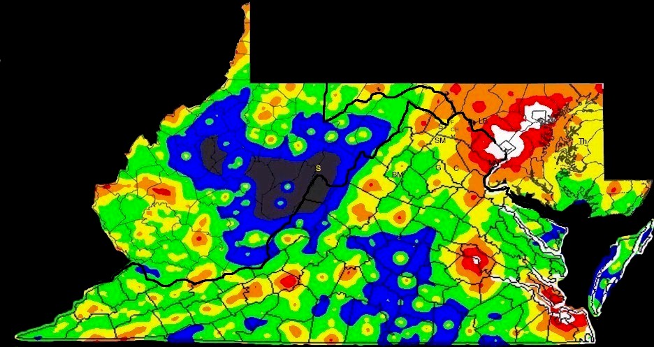
Virginia, Maryland and West Virginia Light Pollution Maps
Forrest Hamilton of the Maryland section of the International Dark Sky Association (IDA) has divided the World Light Pollution Atlas into states and added county lines. Thanks to Bob Bunge for the idea and getting permission for their use.
More information on the Bortle scale used in the maps below
Click photos to enlarge
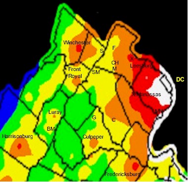
Northern Virginia
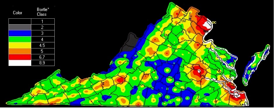
Virginia
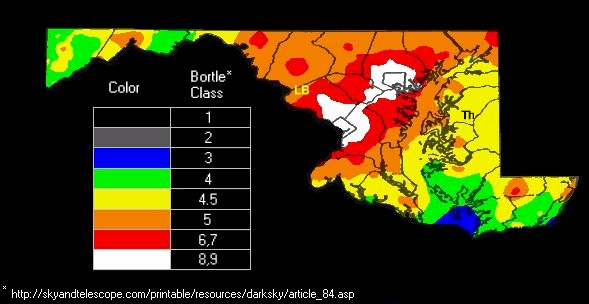
Maryland
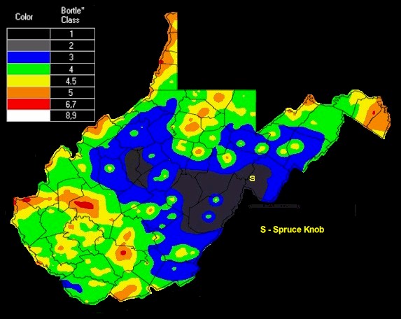
West Virginia
All Areas
To learn more about light pollution, visit these websites:
VOLT – The Virginia Outdoor Lighting Taskforce
International Dark Sky Association
The World Light Pollution Atlas
Photo copyright http://www.lightpollution.it/worldatlas/pages/copyright.html