NOTICE:
TURNER MOUNTAIN IS TEMPORARILY UNAVAILABLE FOR NOVAC USE. More details will be posted when they become available.
The Plains, Virginia 20198
Special Covid-19 Notice: Turner Mountain is open for use by our members and their guests. Please maintain approximately 20 feet separation between scopes and keep a minimum of six feet separation between people. Also, use the porta-toilet at your own risk. If you do use it, it is highly recommended to bring your own hand sanitizer to disinfect your hands after its use.
New Gate Lock Combination and protocol for use of the gate:
Effective 1/20/2021 the lock combination is 0318. The new gate and lock protocol for NOVAC members to follow is:
(Assume the gate is in the closed and locked position when arriving)
- Open the lock by entering the 0318 combination and depressing the lock hatch fully.
- Open the gate.
- Lock the combination lock onto the last link of the chain and dial the numbers on the lock to 0000.
- Observe as desired on the field.
- The last person leaving the site is to always close and lock the gate.
Step 3 above is important as this prevents passers-by from reading the combination off the lock if it were to be left in the unlocked position.
When gate is properly closed and secured the lock should be set to display 0000.
When the gate is properly opened, the lock should be locked on the last link of the chain with the lock set to display 0000.
Regardless if the gate was open or closed when the first person arrived at the site, the last person who leaves the site is to close and lock the gate.
If you have any questions, please contact the site coordinator via email.
Observing Field Coordinates:
Latitude: 38° 53′ 35″ N Longitude: 77° 44′ 22″ W
Latitude: +38.89306 Longitude: -77.73946
Elevation: 960 ft
Intersection of Halfway Road and Turner Mountain Road Coordinates:
Latitude: 38° 53′ 49″ N Longitude: 77° 44′ 45″ W
Latitude: +38.896881 Longitude: -77.745859
Site Access Gate Coordinates:
Latitude: 38° 53′ 26″ N Longitude: 77° 44′ 39″ W
Latitude: +38.890626 Longitude: -77.744275
Coordinator: Arlen Raasch araasch@gmail.com
Click here for the Turner Mountain Agreement
Turner Mountain is a privately owned site which NOVAC member Charles Turner III has graciously made available to NOVAC club members for observing.
Notice: The gate combination has been changed, it is now 0318.
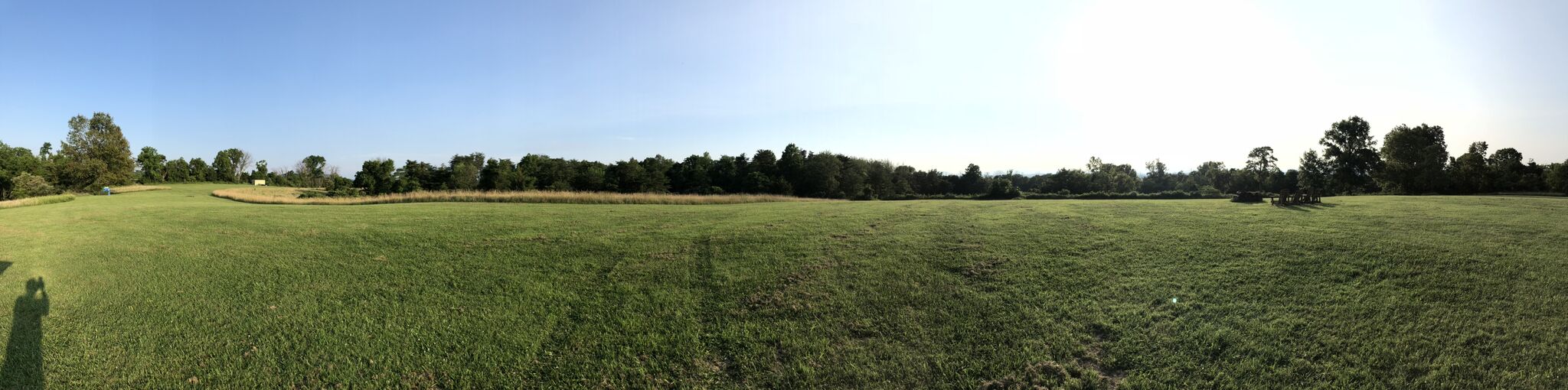
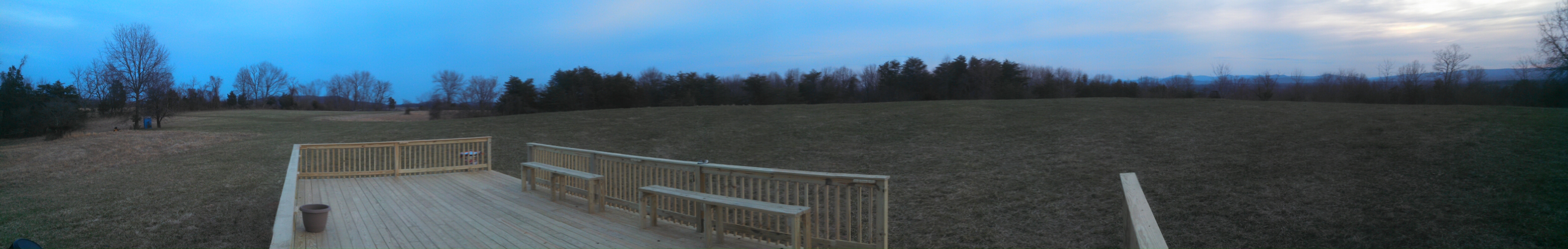
This is the deck located next to the observing field along with a panoramic view from the deck:
About
The site offers beautiful views of the rolling hills in the area during the daytime, as well as quite dark skies at night with excellent views to the South and West. The site elevation and topography also seems to helps to reduce the formation of dew on astro gear, which is a welcome benefit.
Unless otherwise posted on the NOVAC listserver or this web page, the site is available for observing year round.
The access roads to the site start out as cinder roads which are steep at times, and transition to unimproved farm roads once you enter the site access gate. When the roads are dry, most cars should have no problem accessing the site. However, if there have been heavy rains recently, or if snow / ice is present, then four wheel drive will likely be required. If your vehicle brakes are not in good repair, don’t drive to the site, as you will need them to drive down Turner Mountain safely.
When you plan on observing at the site, you are required to post a short note to the NOVAC listserver indicating that you are about to do so. You are no longer required to sign a logbook when using the site.
Also note that camping at the site is permitted. Please use common sense when doing so, I.E. leave the site in the same or better condition as it was when you arrived, no open fires, don’t cook next to other’s scopes, etc.
NOVAC members are asked to check that the observing area is free of any litter prior to leaving the site.
A portable restroom is located to the Southeast of the observing field next to small group of trees. You may wish to note its location in the daytime, as finding it for the first time at night could pose a bit of a challenge.
A copy of the memorandum of agreement between Charles Turner III and NOVAC is available here. Please read it before using the site.
New site improvements completed in January, 2016!
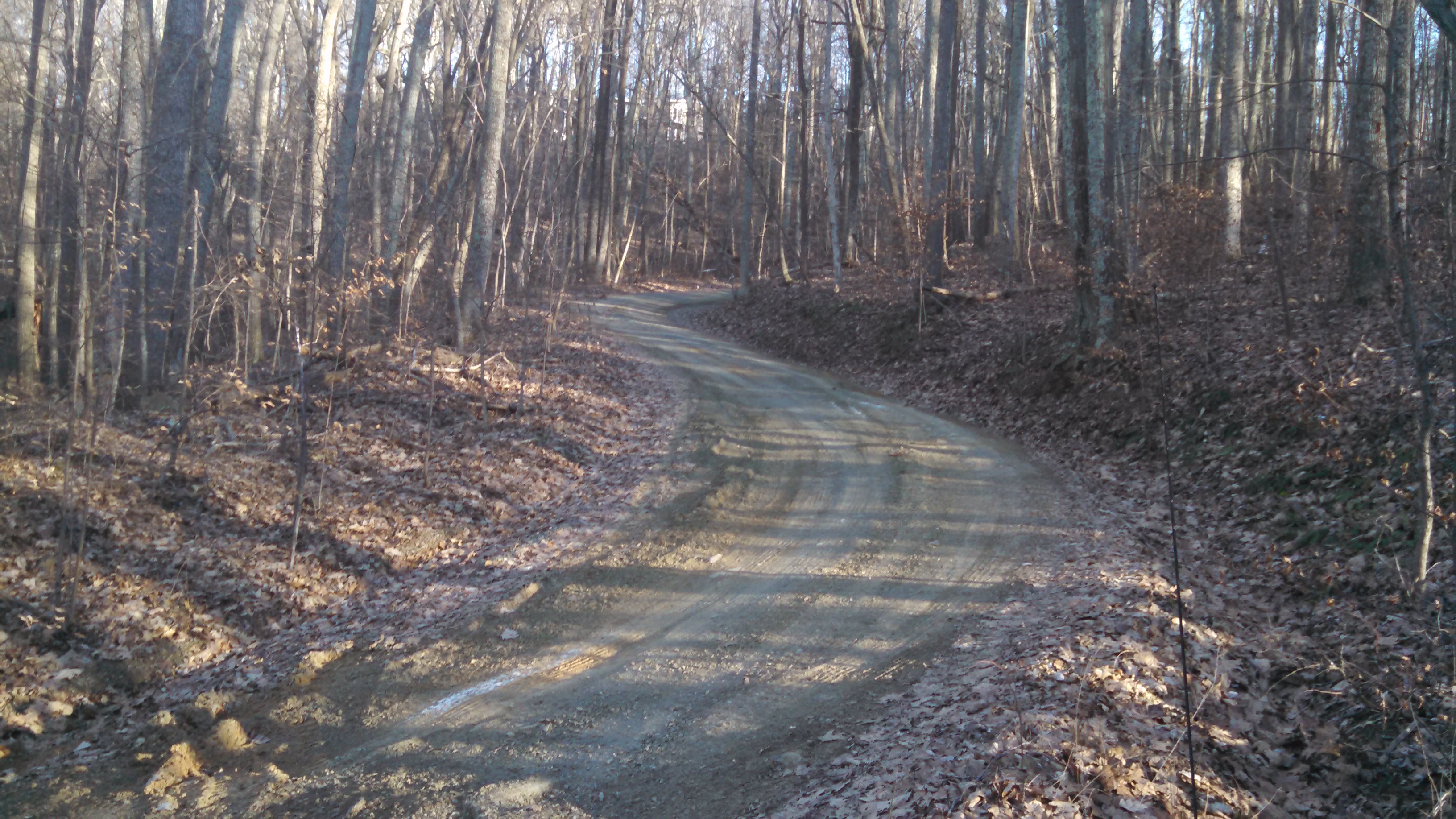
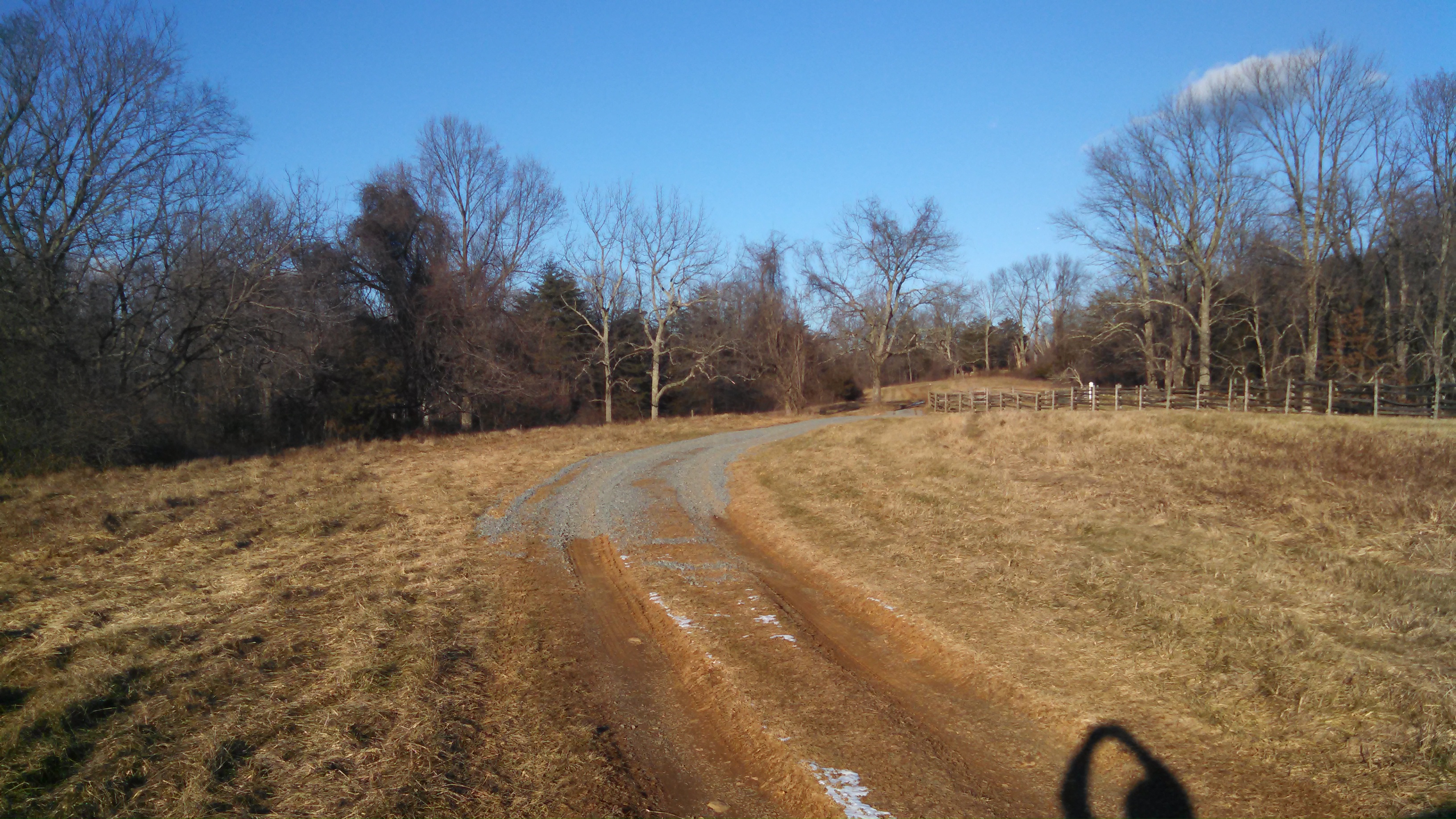
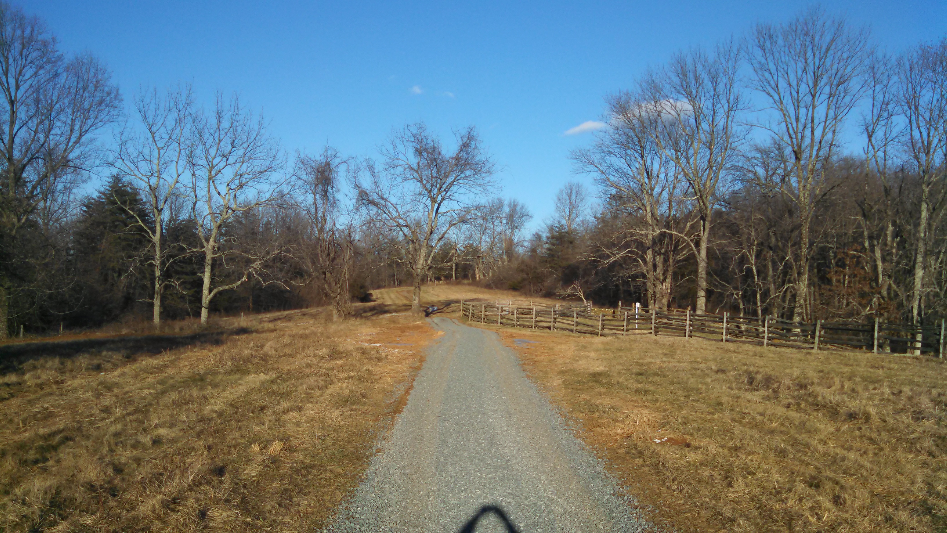
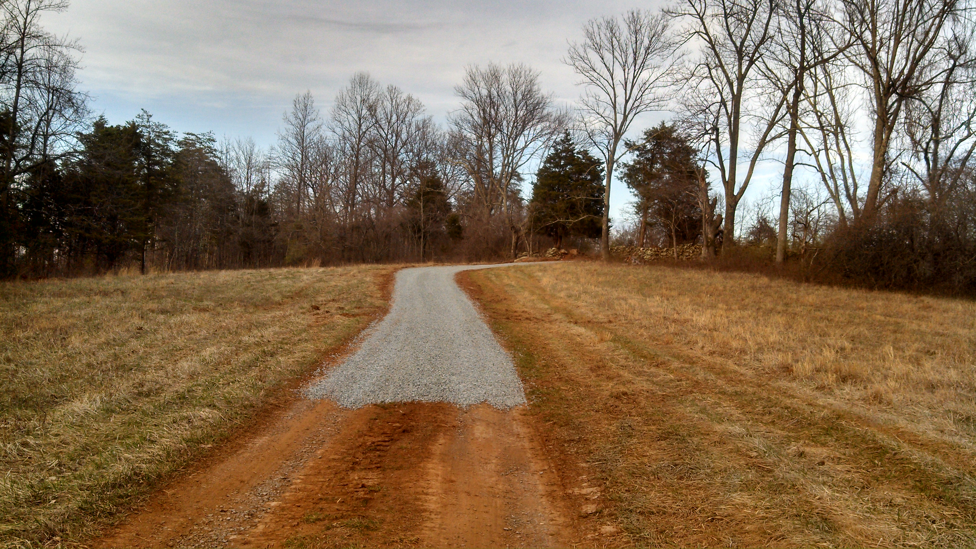
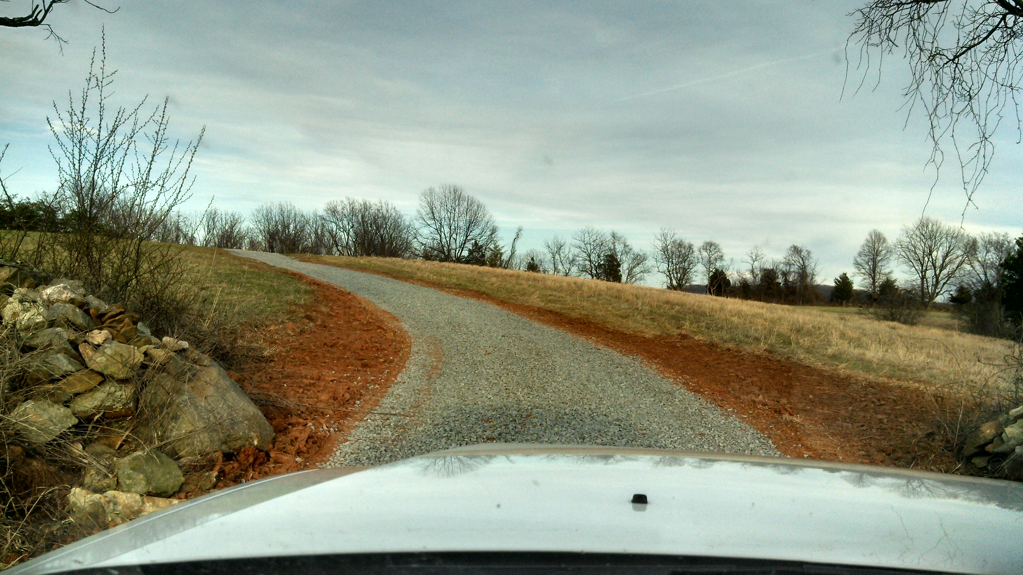
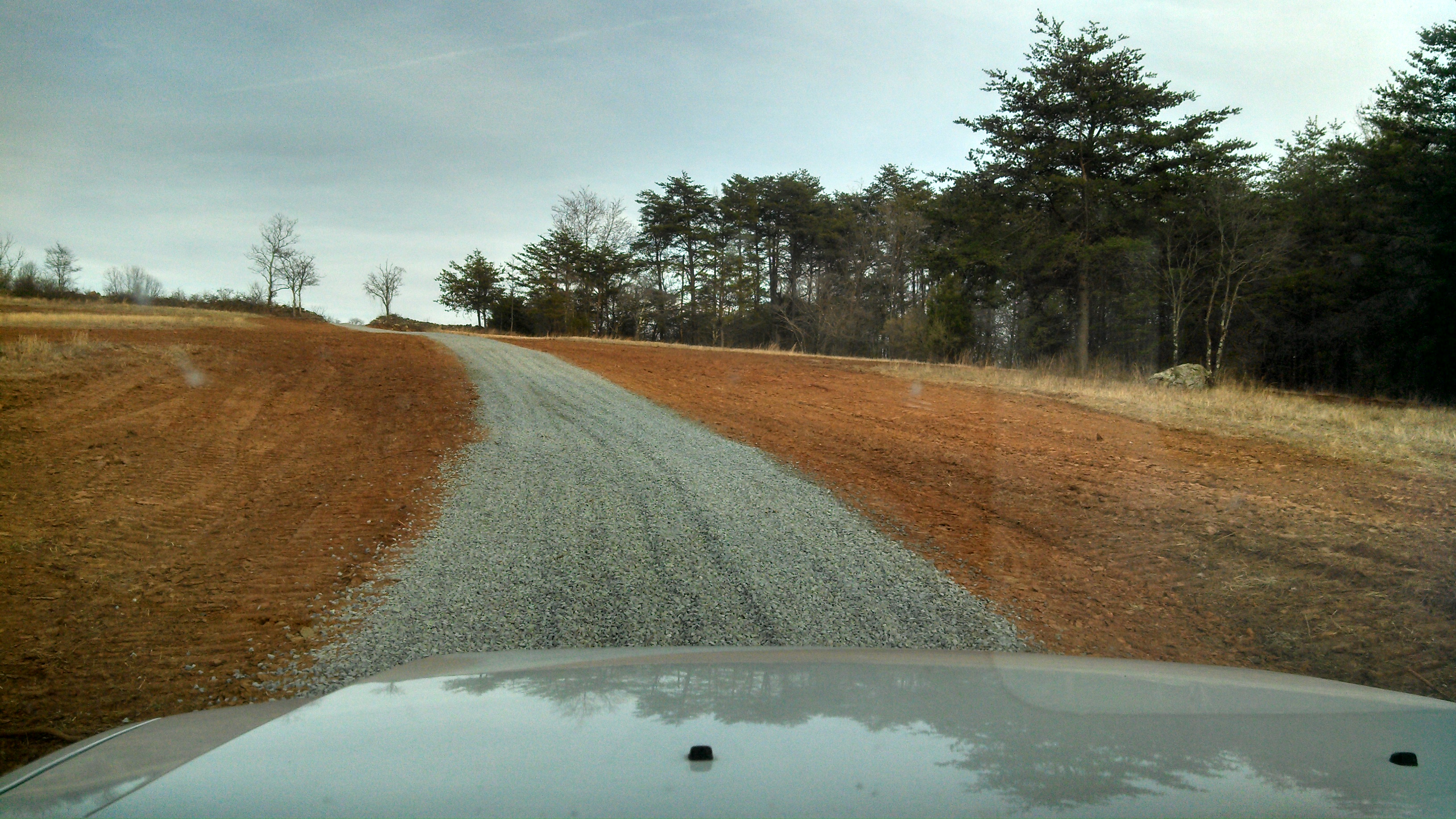
Charlie Turner has been hard at work at the site and completed making improvements to the farm road approaching the observing site including adding a drainage pipe under a section of the road that was often muddy in wet weather. This section of the road has also seen the addition of crushed gravel as can be seen in the photos. The access road to the site has also been graded and is in great shape. Thanks Charlie, for making these awesome improvements!
 Recently graded road going up the hill
" data-large-file="https://www.novac.com/wp/wp-content/uploads/2012/12/IMG_20160118_160325_197-1024x576.jpg" class="size-medium wp-image-174515" src="https://www.novac.com/wp/wp-content/uploads/2012/12/IMG_20160118_160325_197-300x168.jpg" alt="Recently graded road going up the hill" width="300" height="168">
Recently graded road going up the hill
 Start of farm road improvement
 Detail of newly improved farm road
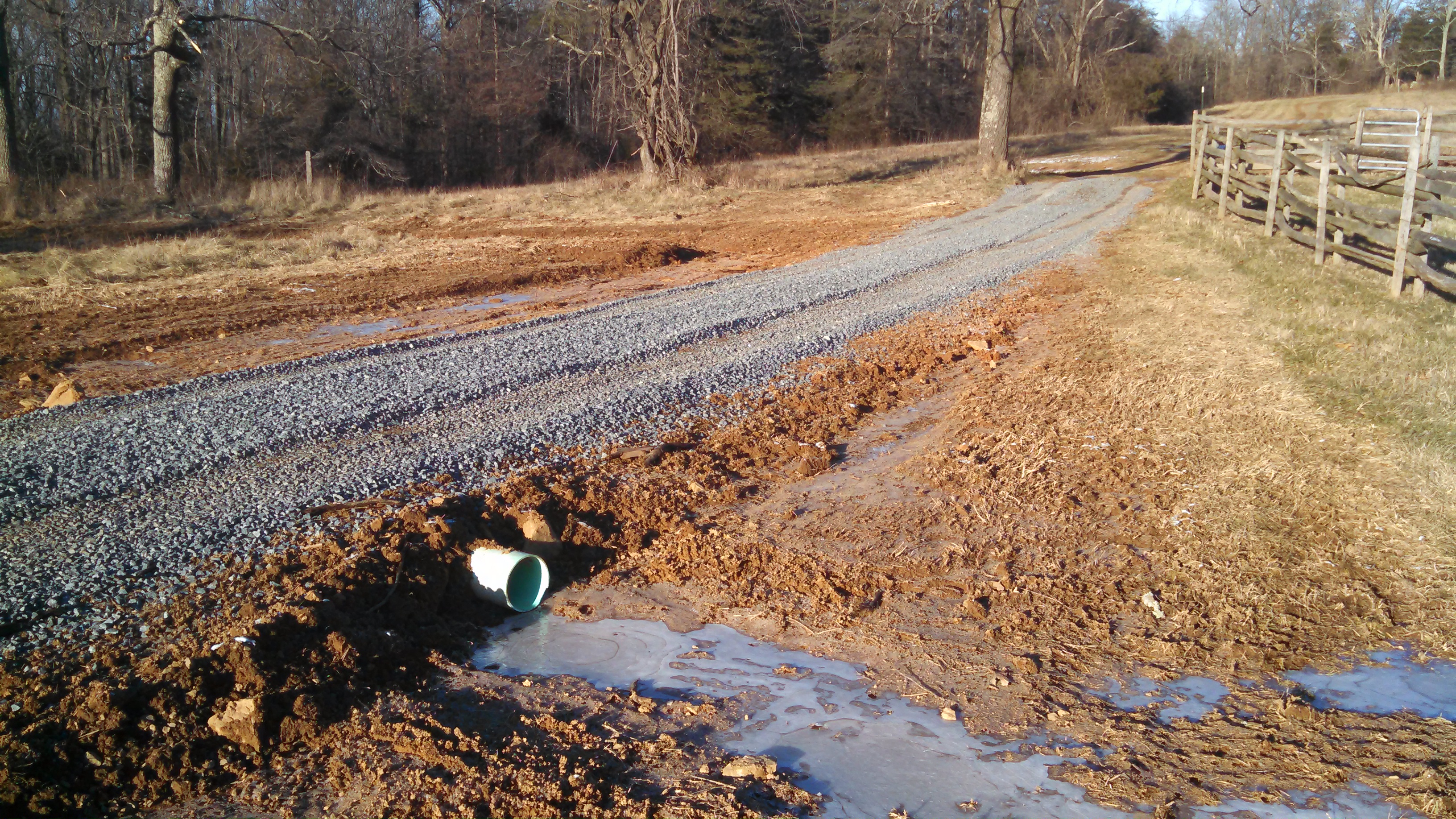 Drainage pipe under farm road
New site improvements completed in April 2014!
The site owner recently completed two improvements to the site, installing a large wooden deck alongside the observing field and vastly improving the access road to the site which will ease access to the site. NOVAC members and their guests are welcomed to use the wooden deck. Please avoid using anything on the deck that would harm the deck like telescope tripods with sharp metal points on the legs.
Here are views of the road improvements which cover roughly the last two-thirds of what was the unimproved farm road leading up to the site:
Video Directions
Directions to Turner Mountain
From The Plains, Virginia, Turn North onto Loudoun Ave and follow it out of The Plains 2.9 Miles. As you leave The Plains, you will come to a railroad crossing and come to the intersection of Loudoun Ave and Hopewell Road.
Continue on Loudoun Ave, which will eventually become Halfway Road.
2.9 miles from The Plains, you will come to the intersection of Halfway Road and Turner Mountain Road.
Turn right on Turner Mountain Road and zero your trip meter if you have one.
Approx 150 feet up Turner Mountain Road you will pass an entrance to a house on the right with a sign “3388” displayed. Just go straight on Turner Mountain road here.
Approx 300 feet further up Turner Mountain Road you will see a white “End State Maintenance” sign just before a fork in the road.
Take the right fork here and continue up Turner Mountain Road.
As your trip counter reads .1 miles, you will see two stone posts on the left hand side with “3395” and “Smoky Hill” engraved on them. This is not the entrance, just continue up Turner Mountain Road.
At .2 miles on your trip counter, you will come to another fork in the road, take the left fork which is marked with a sign labeled “UP” and an arrow pointing left.
At .4 miles a road from below will join with Turner Mountain Road on the right. This is the road you will use later when you leave to go down the mountain. It is marked with a “Down” sign which you can see as you go past the intersection.
Continue up the mountain on Turner Mountain Road.
Approx 100 feet further up Turner Mountain Road you will cross a livestock barrier, continue up the hill on Turner Mountain Road.
At .5 miles on your trip counter you will come to a maroon sign “Kinburn 3515” and an arrow pointing left. A few feet further up the road you will come to a fork, take the left fork.
Continue approx. 150 feet and you will see a split rail fence and a pair of wooden posts, one with a yellow “Posted Private Property” sign on it, Attached to the right post is a green gate. Drive through the gate on the farm access road.
Note: The gate may be locked. There are three locks that are used to open the gate, only one is a combination lock. The combination is 0318.
Once you dial the correct combination into the lock tumblers, you must press the lock shackle in before the lock will open.
To prevent others from reading the lock combination from the lock when the gate is opened for observing, secure the lock through just the last link of the chain, close the hasp, and spin the dials to 0000.
You are no longer required to sign in/out in the site logbook when using the site.
The last person leaving the site should always close the gate and lock it. Set the lock to 0000 after locking the lock.
Follow this access road up to the observing site at the top of the mountain.
You will pass through several clearings as you do so.
As your trip counter shows .9 miles, you will be arriving at the base of the observing area.
As you leave the site, just drive down hill on the same roads you came up on, with the exception of following the “Down” sign as you come to it.
You must be logged in to post a comment.